Nineteen students enrolled in Advanced Geographic Information Systems (GIS 3) with Scott Drzyzga, a geography and earth science professor at Shippensburg University, replaced textbooks with drones for a day, and stepped outside of boxy classroom walls to get knee-deep in the melted snow-soaked Hornbaker Wetland.
Hornbaker Wetland is located off campus where Britton Road meets Fogelsanger Road, and was restored between 2001 and 2002 during the Burd Run Restoration Project. During the restoration project, an artificial drainage ditch in the wetland was blocked to increase water storage and hydraulic retention time, and diminish the downstream delivery of nitrate, according to Christopher J. Woltemade and Jinnieth Woodward’s “Nitrate Removal in a Restored Spring-Fed Wetland, Pennsylvania, USA.”
Since its completed restoration, the wetland has been undergoing natural changes and has served as an outdoor classroom for students in departments including geography and earth science, biology and geology, so that they may study its transformation, Drzyzga said.
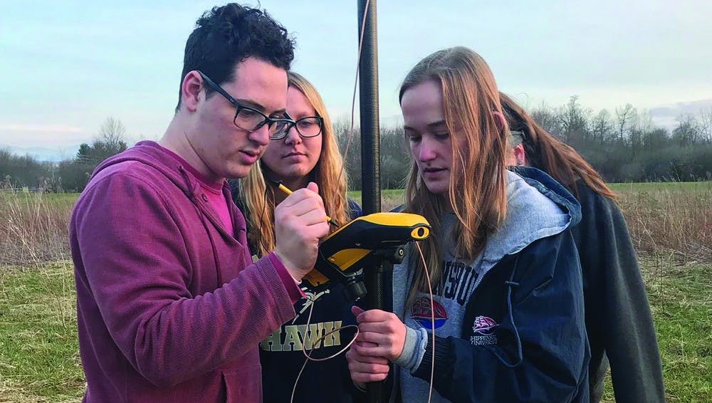
Taking advantage of the instructional resources that Hornbaker Wetland has to offer, the GIS 3 class split into two groups. Equipped with satellite positioning technologies, a DJI Mavic drone and their cellphones to view the route, the students re-mapped the wetland on March 31 and April 2.
While drones are not new gadgets in the geography and earth science department, this was the first time the GIS 3 class used a drone for a lab exercise. It challenged the students to apply critical thinking skills to the material they learned in the classroom.
“It’s one thing to read a textbook and learn that buildings and trees and other things can interfere with, for example, GPS signals,” Drzyzga said. “But it’s quite another thing to walk around with a GPS device and try to get good data and have a water tower or tree canopy influence the quality of results. When you go through that process and it’s all first hand, that sticks with you more than a paragraph you may have read.”
Approaching the lab strategically, students planned and executed the drone-mapping project in three distinctive steps, said junior geoenvironmental studies major Joshua Chast, who participated in the lab. These steps included preparing the instruments for field data and considering external variables, getting into the field and recording, and extracting useful information from the data acquired.
For this lab, the data the students obtained were the approximately 180 aerial photographs that the drone took as it traveled its predetermined route. These images were then stitched together to create the map of the wetland in its current state.
“All we had were photographs from before the restoration and aerial photographs from immediately after the restoration,” Drzyzga said. “Fifteen years ago we would have had to put a real plane up in the sky. So now that we have radio controlled drones, students can see it first hand.”
Because of the successful visual results obtained during the lab, students will have the ability to compare the updated image of the wetland to the previous images that were taken prior to and following the restoration project for variations in landscape, species and stream migration.
Additionally, professors teaching future courses in the department can use the map to realistically prep their students for fieldwork. The aerial image will show them almost exactly what they will see at the wetland before they go out to survey the area, which is something a standard image would not be able to effectively convey.
“[Drones] fill a critical gap between the pictures we can take with a mobile phone and the pictures we can take from an airplane or satellite,” Drzyzga said. “There’s only so far we can step back with our hands.”
More information about the purpose, process, and results of the GIS 3 class’s lab at Hornbaker Wetland can be found by visiting the class’s map app at https://arcg.is/T1CTi.


The Slate welcomes thoughtful discussion on all of our stories, but please keep comments civil and on-topic. Read our full guidelines here.